
Our StoryWe provide PAS 128–compliant utility surveys, including GPR surveys, electromagnetic location, and live site mark-ups, delivering accurate 2D and 3D CAD and GIS utility survey drawings to support safe excavation, design, and construction projects.
Request a Free Quote
Planning a construction project in London, the South East, or the Home Counties? Magnitude Geo provides PAS 128 utility surveys, GPR surveys, and underground utility mapping to support construction and civil engineering projects.
Request your free, no-obligation quote today and speak directly with an experienced member of our utility survey team about your project requirements.
Who We ArePAS 128 Utility Surveys London, South East & Home Counties | Magnitude Geo
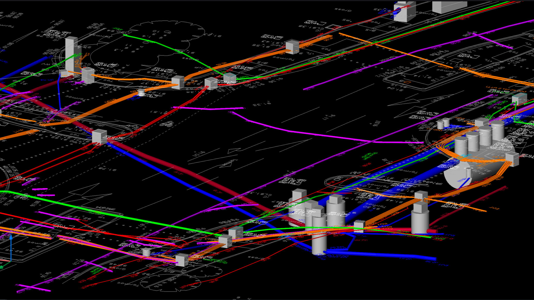
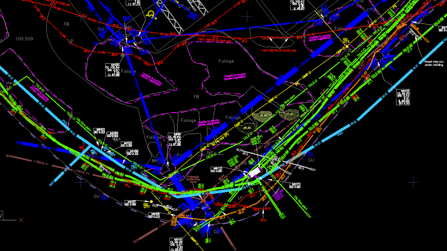
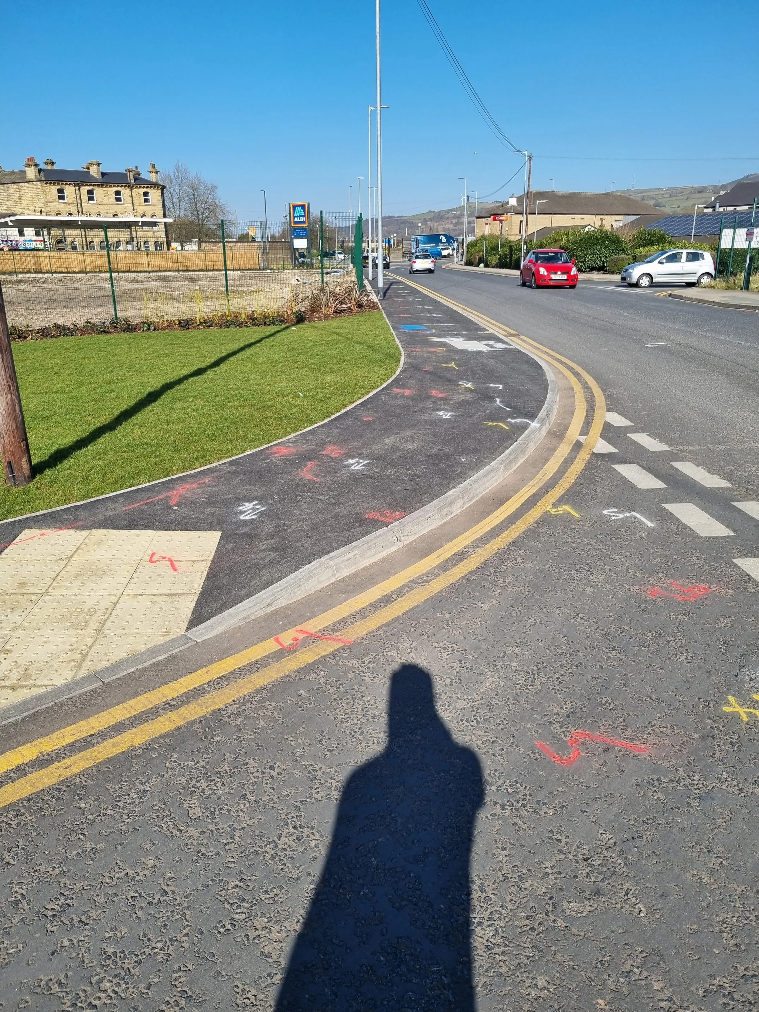
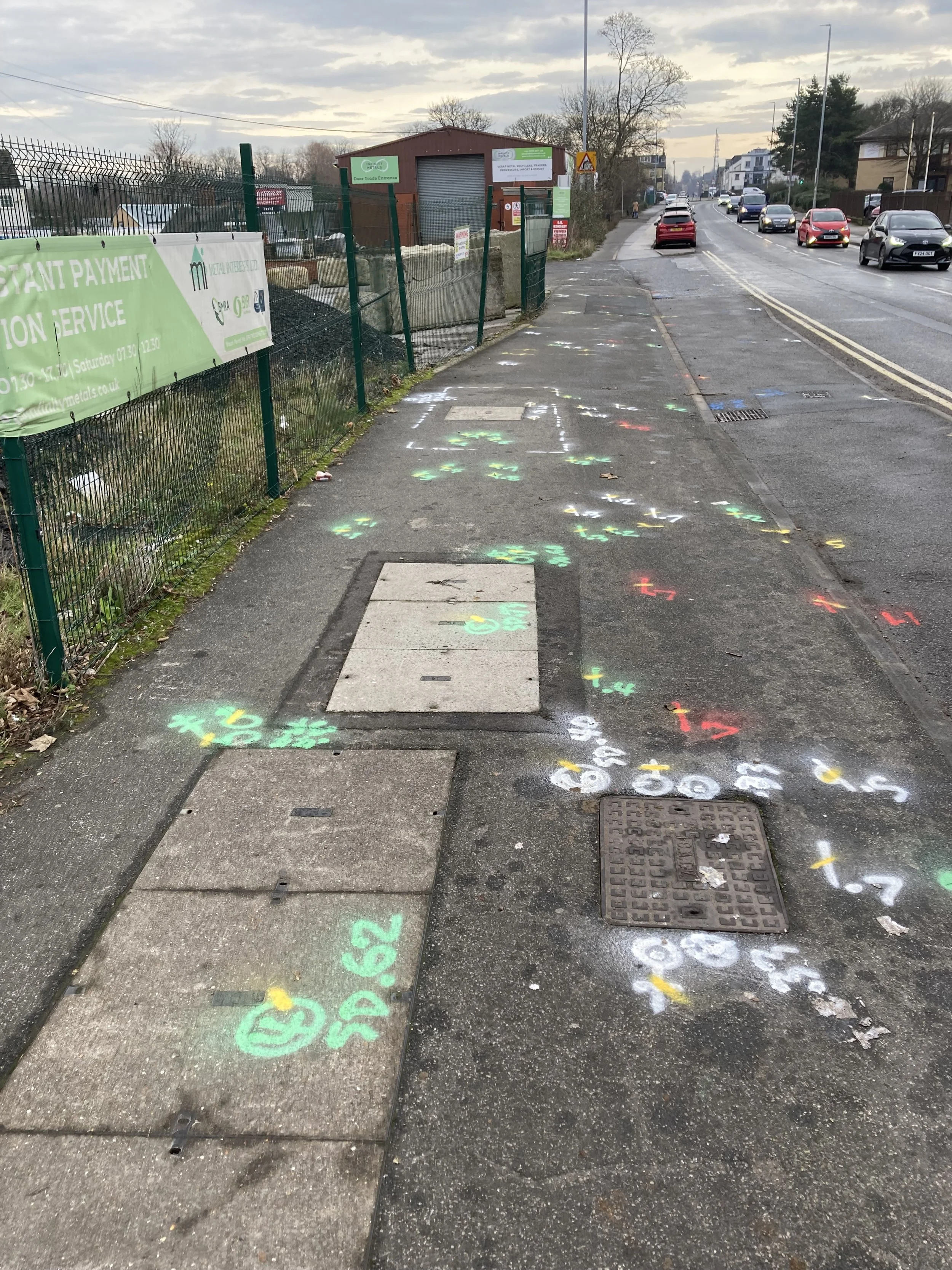
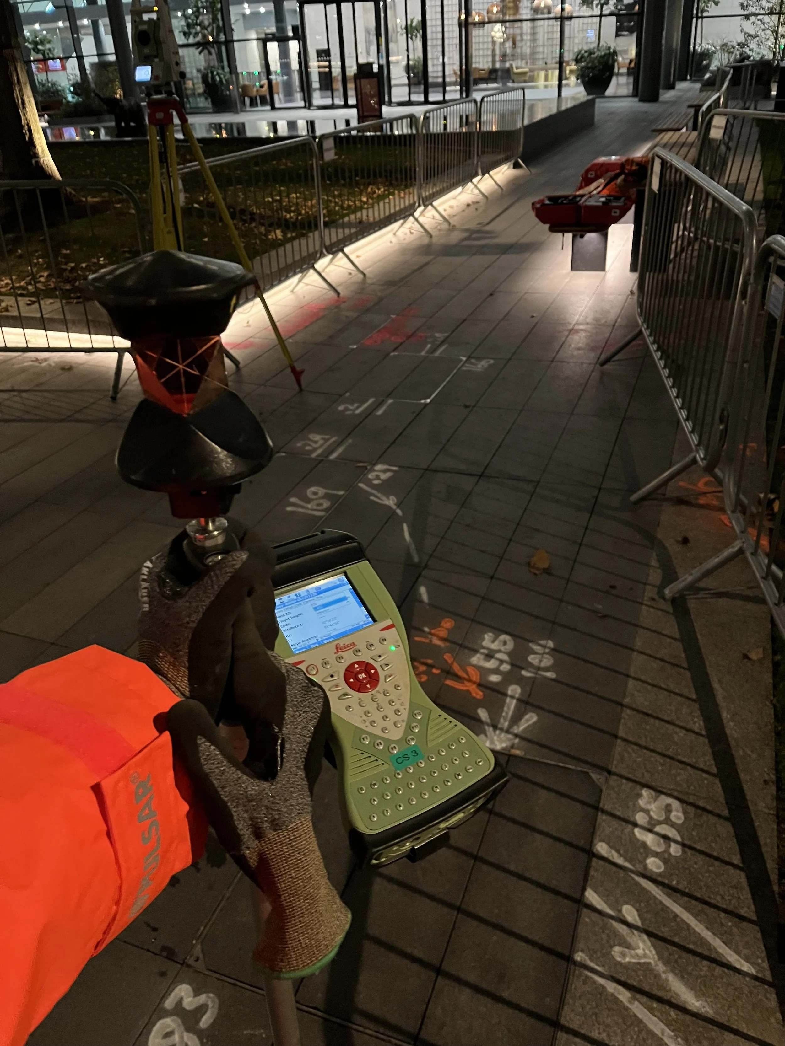
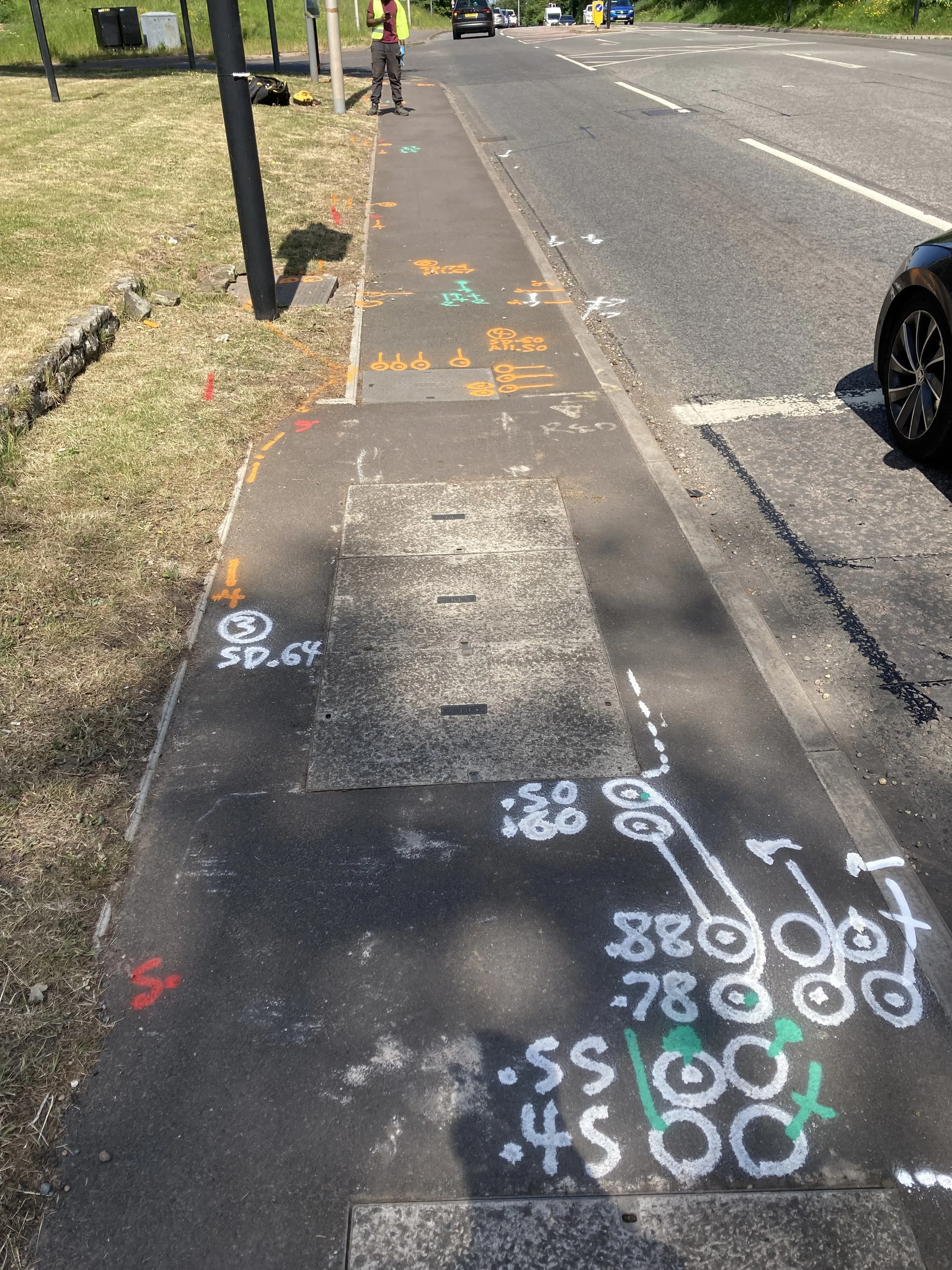
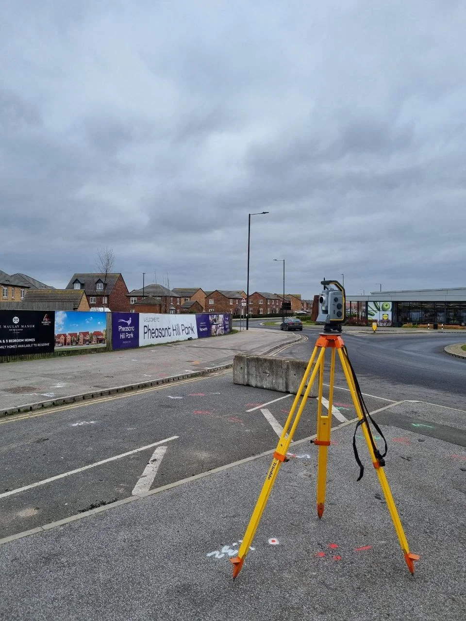
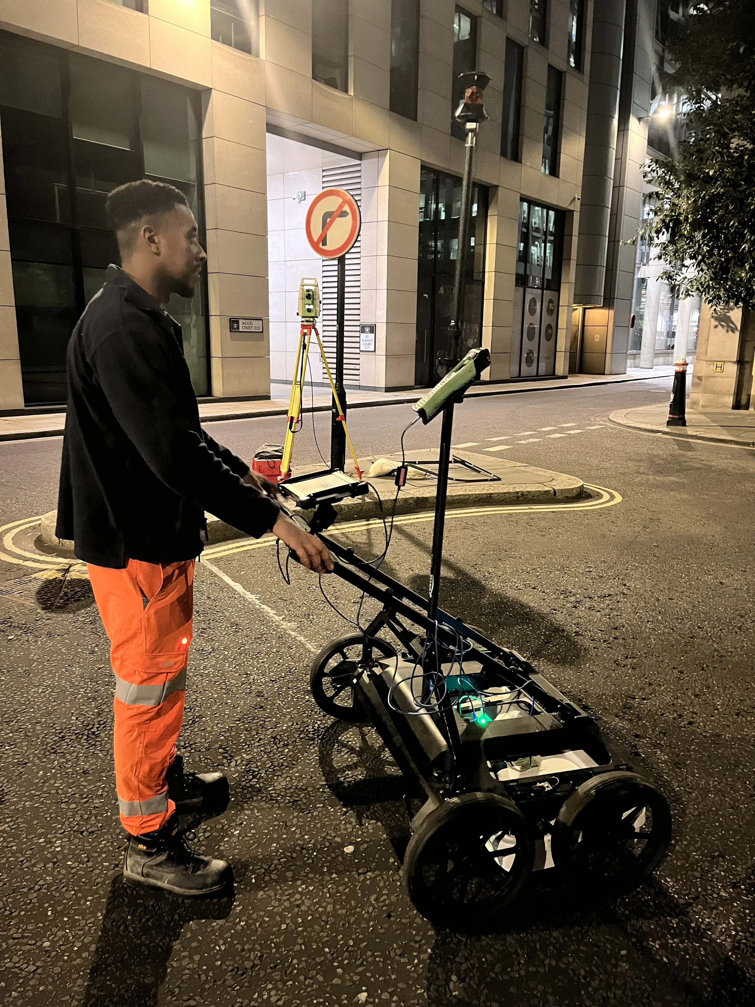
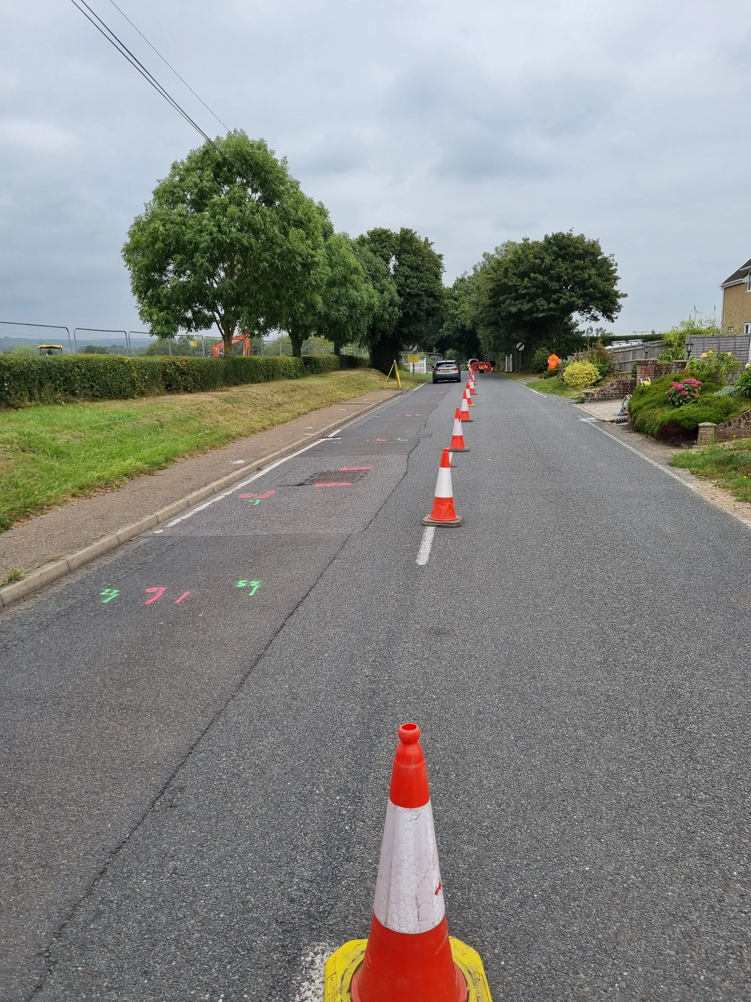
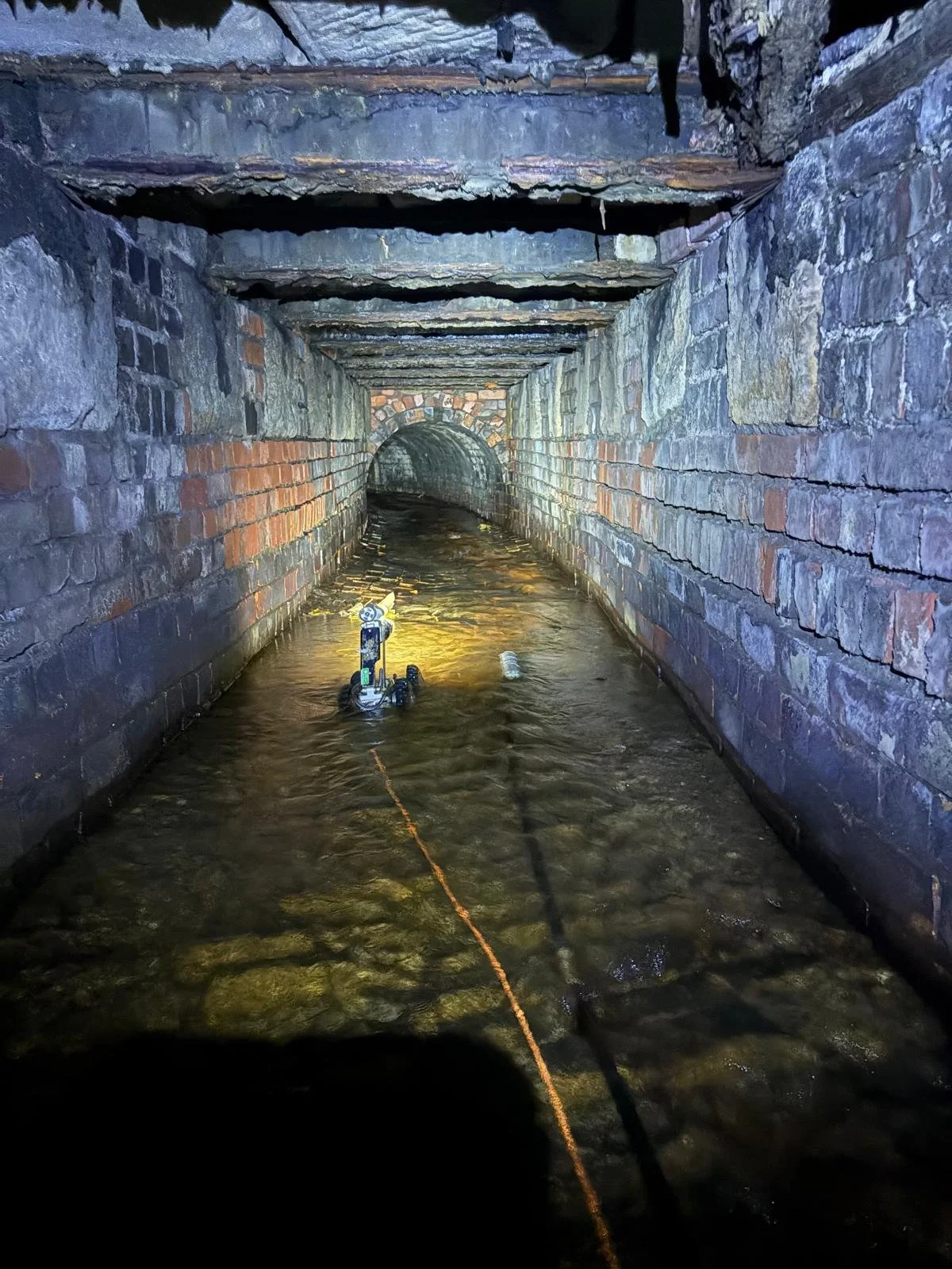
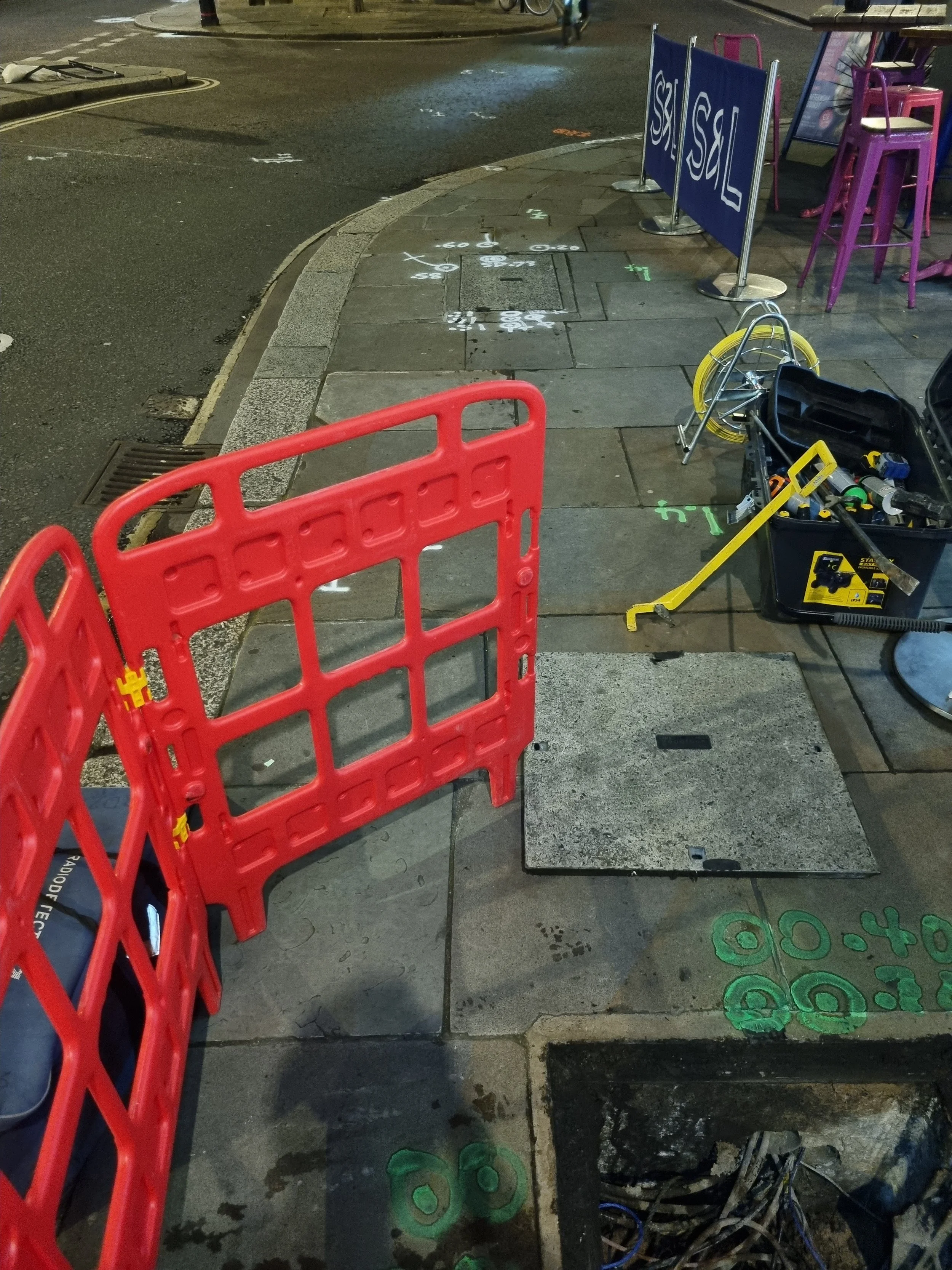
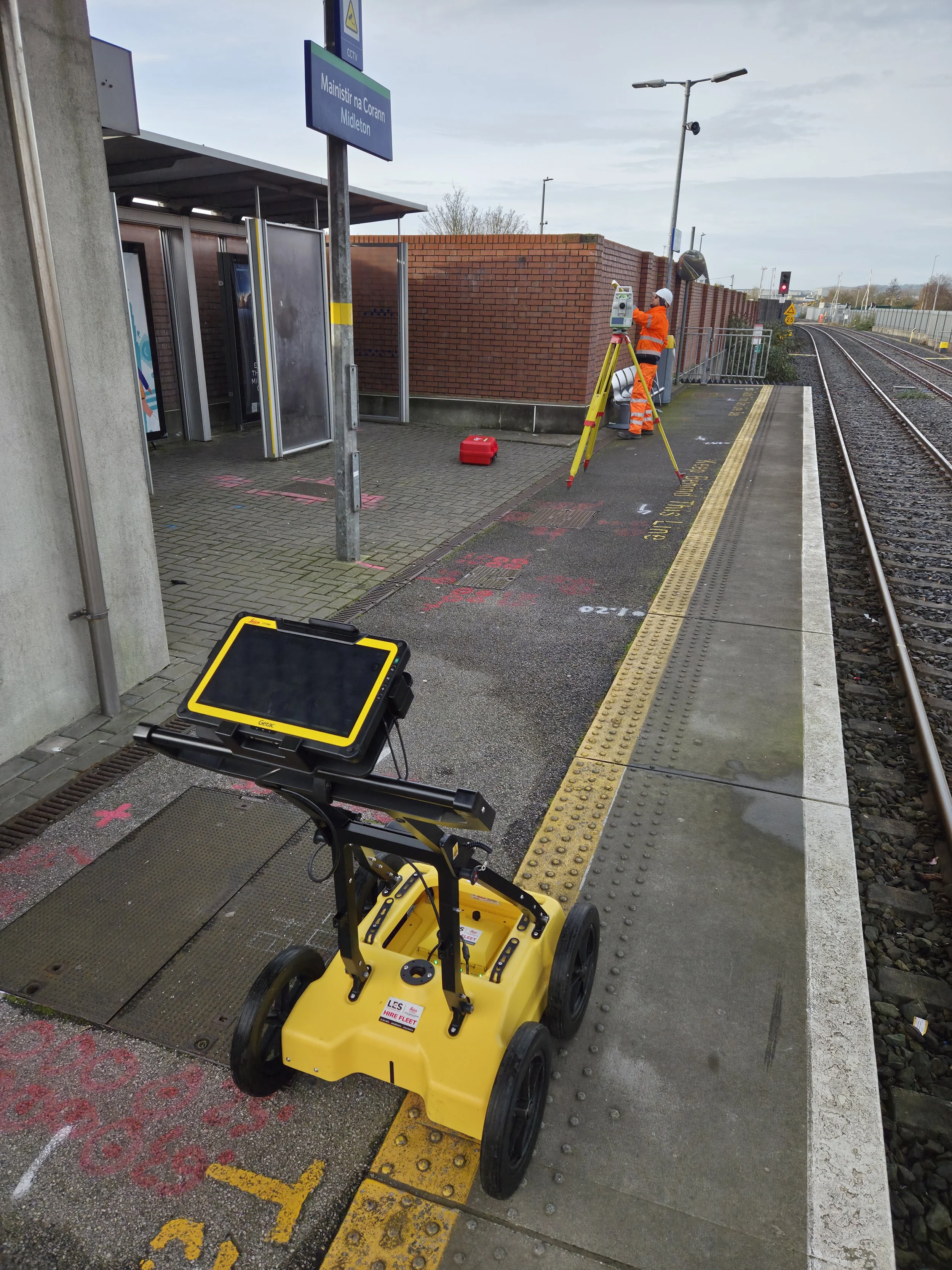
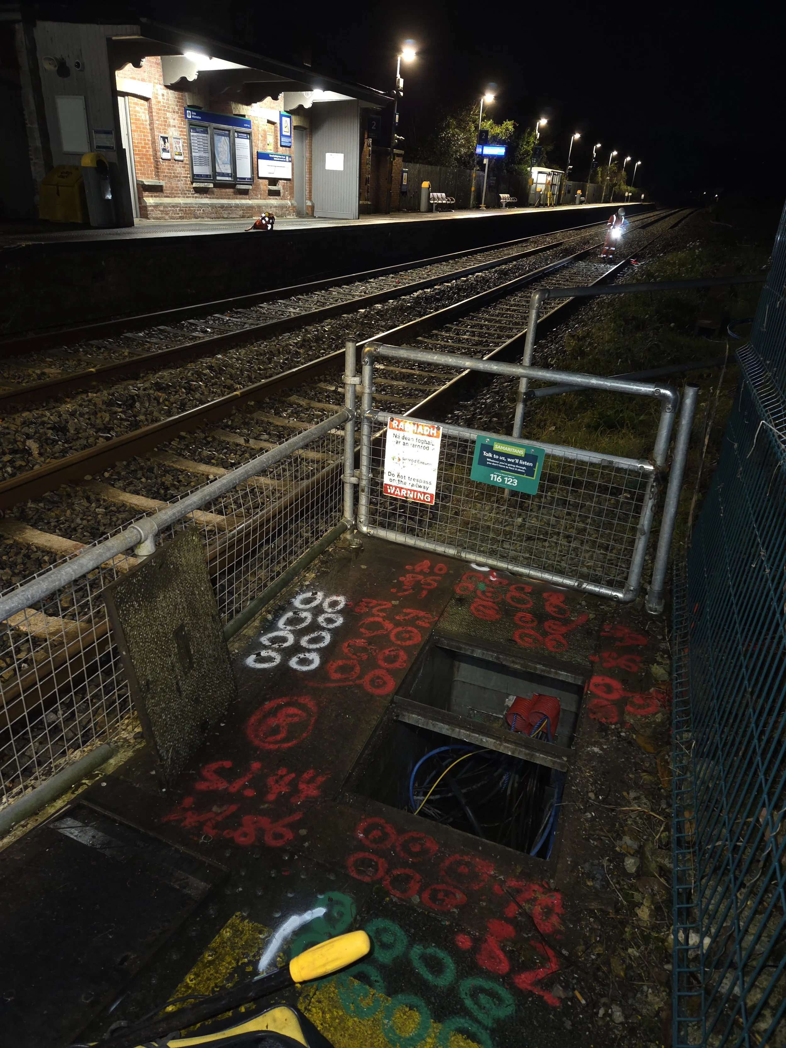
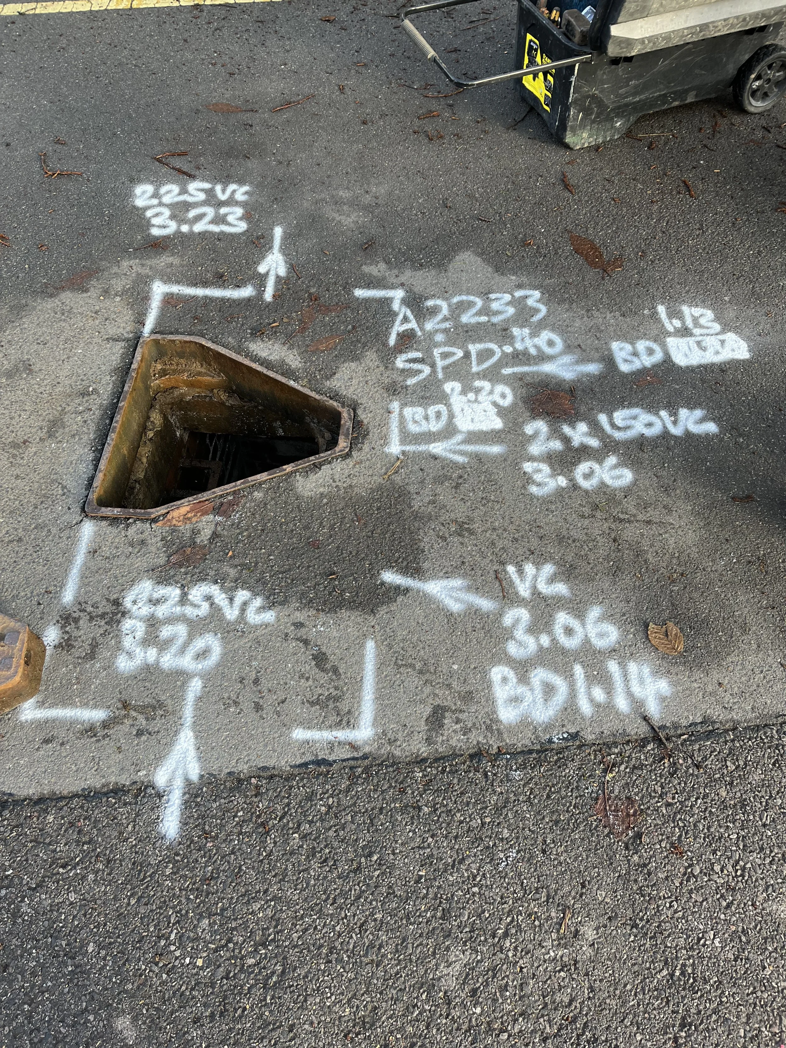
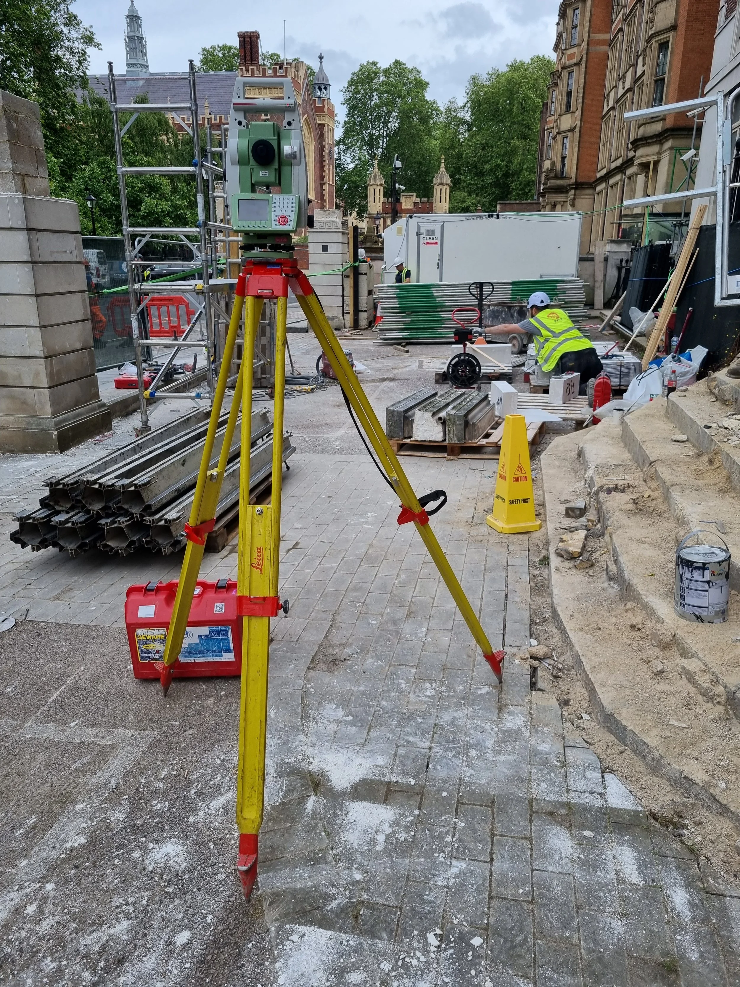
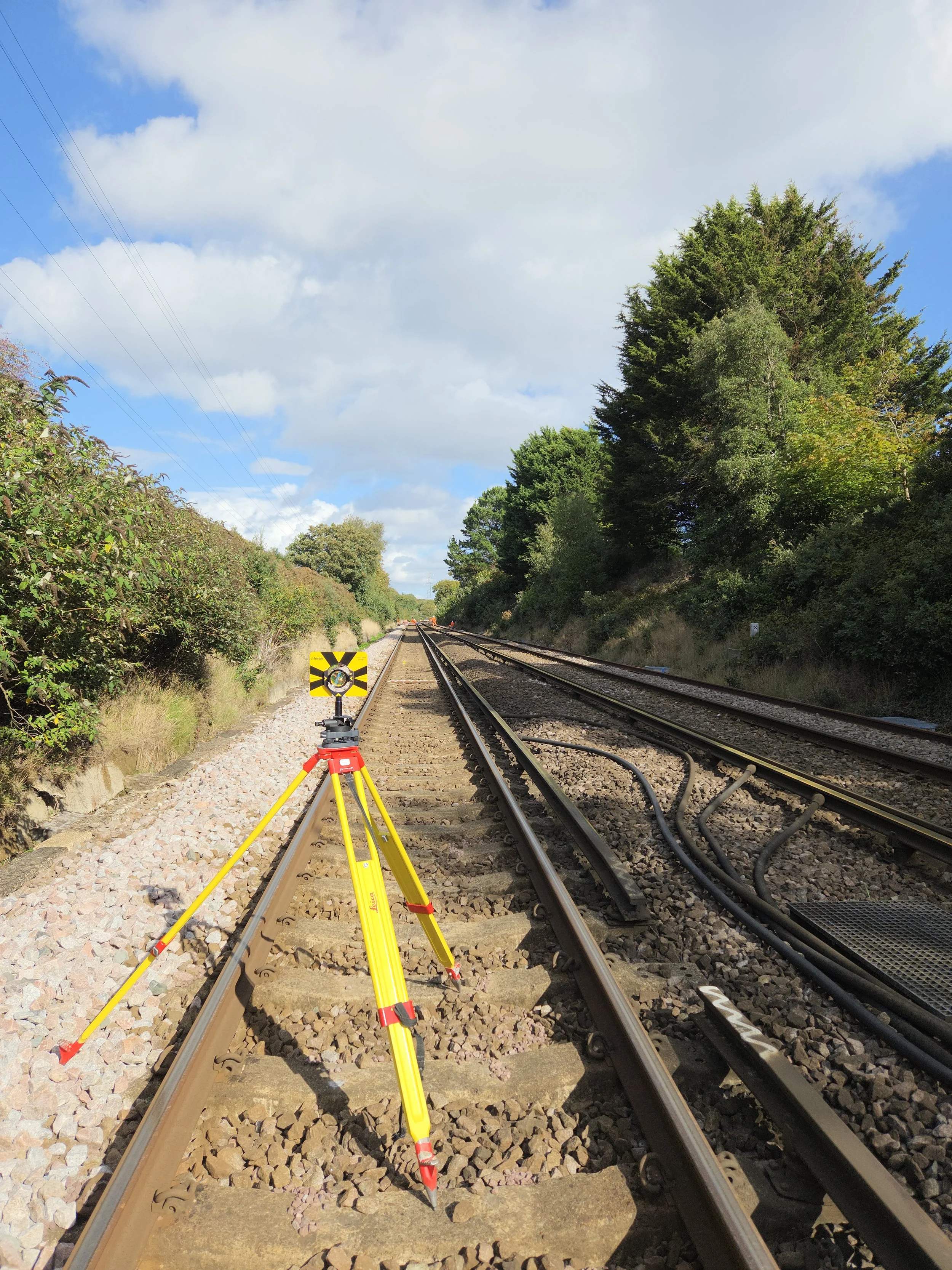
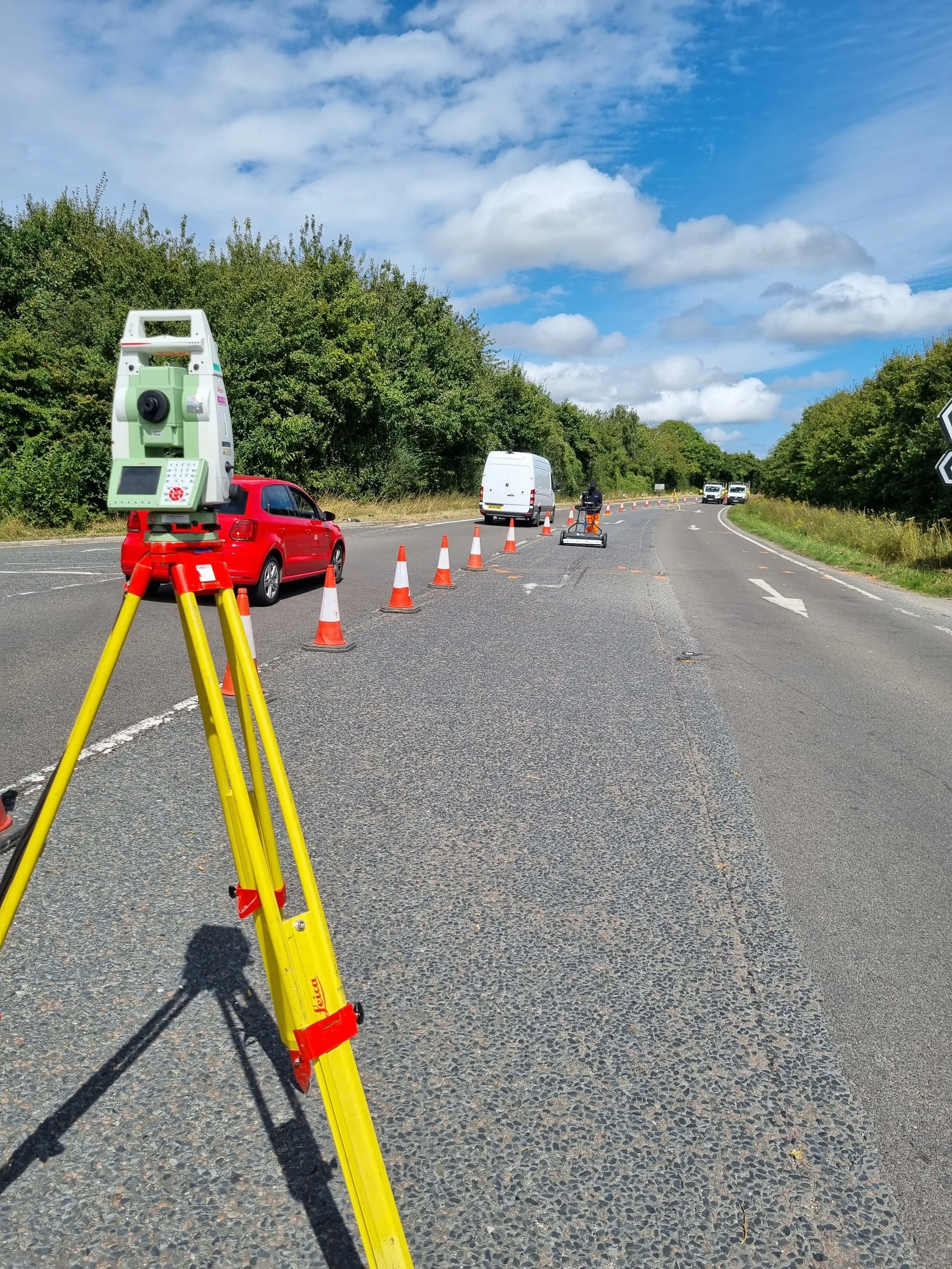
Magnitude Geo provides professional PAS 128 utility surveys across London, the South East, and the Home Counties, delivering high-accuracy underground utility surveys for construction, civil engineering, infrastructure, and redevelopment projects. Our specialist surveyors carry out PAS 128–compliant utility mapping, including desktop surveys, coordination with statutory providers, GPR surveys, electromagnetic location (EML), post-processed GPR data, concrete scanning, trial holes, virtual trial holes, borehole clearance surveys, manhole cards, CCTV surveys, and jetting services to detect and map underground and embedded services in complex environments.
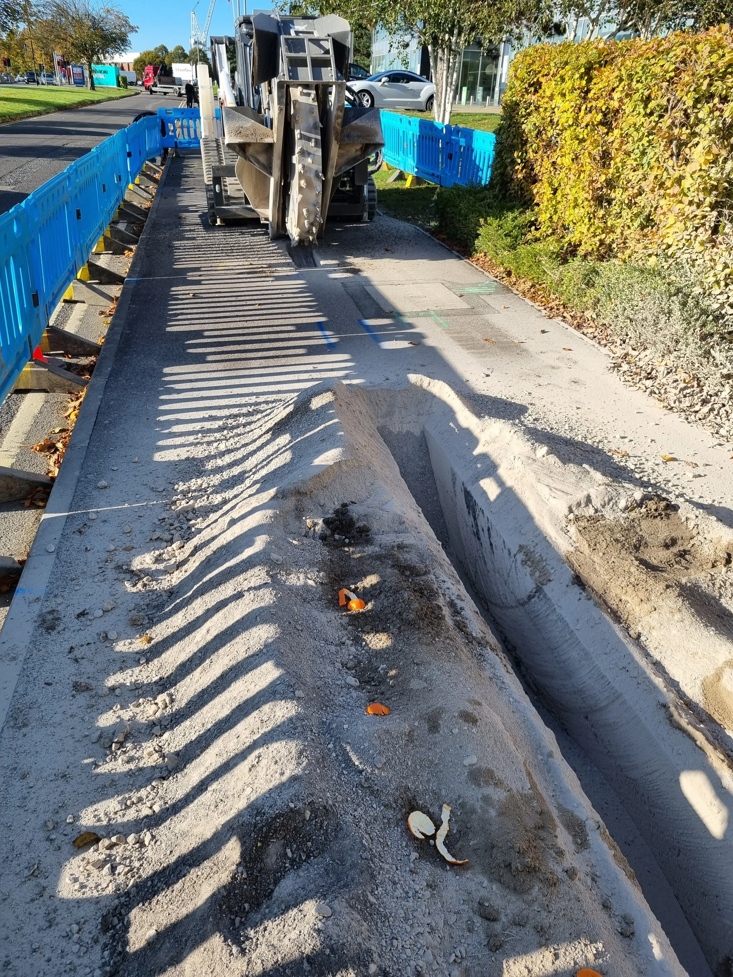
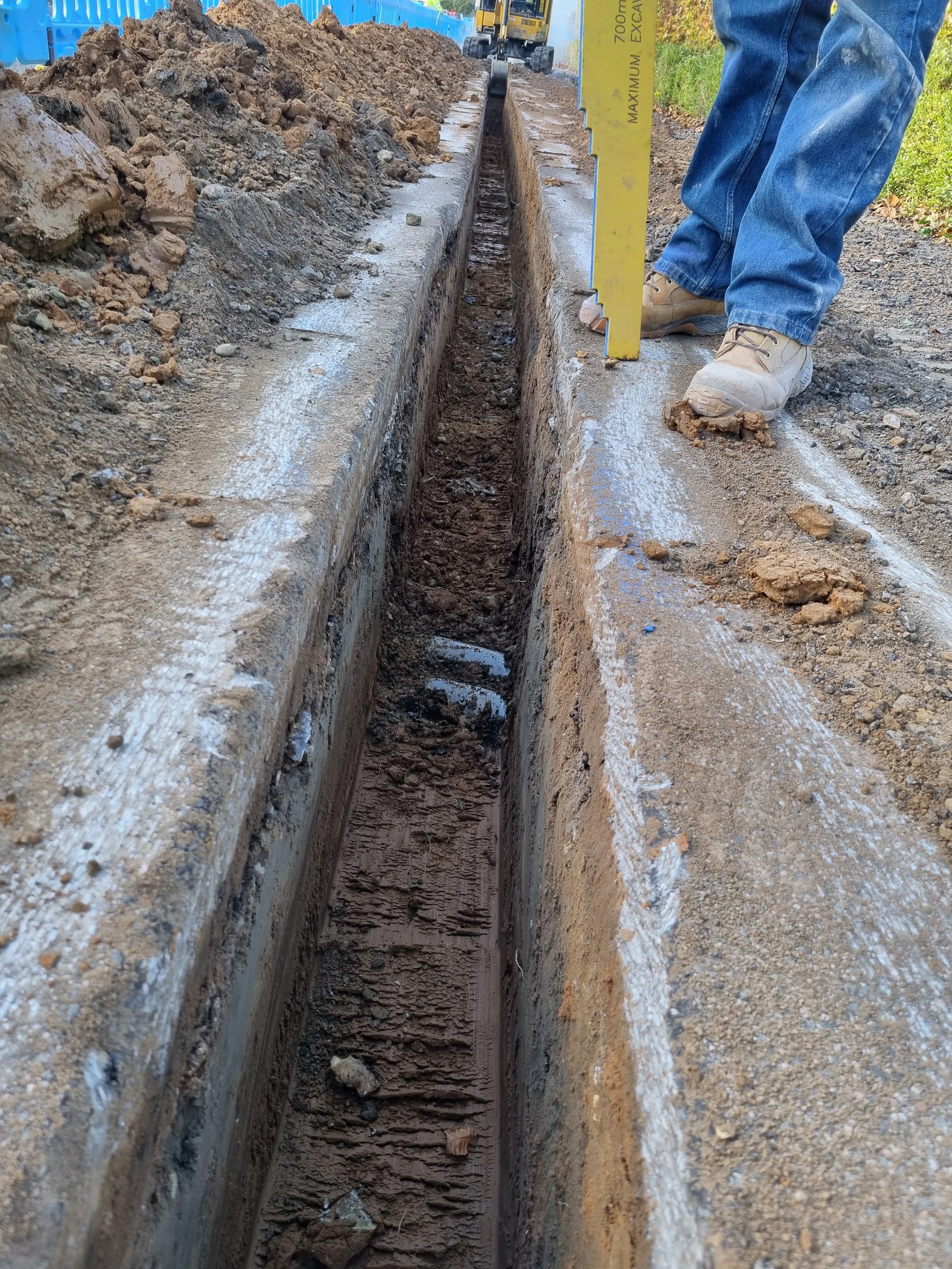
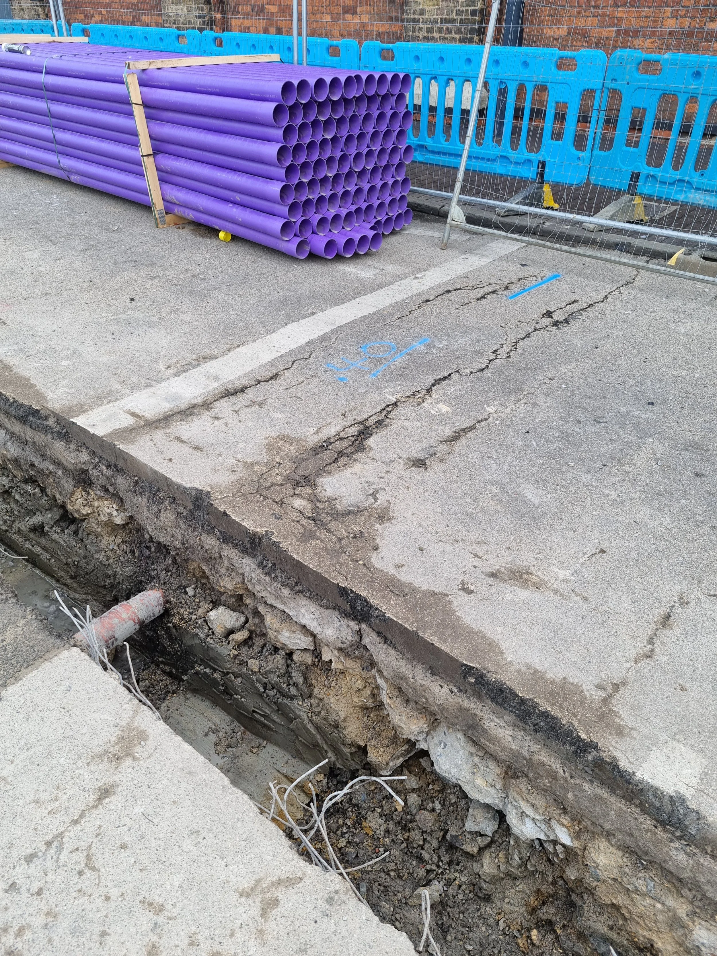
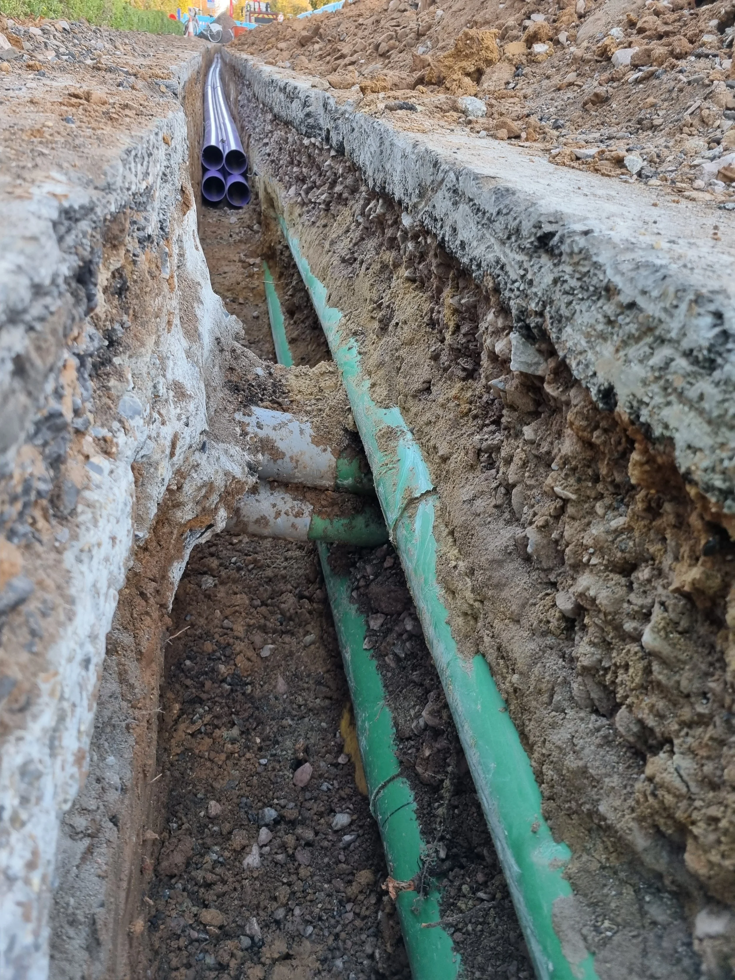
Our surveys identify buried and concealed utilities including low-voltage and high-voltage electric cables, communication and telecoms cables, gas services, water mains, foul drainage, storm drainage, and combined waste drainage systems. GPR surveys with electromagnetic location are used to locate utilities in congested or complex environments, while post-processing of GPR data provides enhanced accuracy and 3D visualisation of subsurface services. Concrete scanning surveys locate post-tension cables, reinforcement, voids, and embedded services within concrete slabs, walls, and structures, supporting safe cutting, coring, and structural works. Trial holes, virtual trial holes, and manhole cards provide precise verification of utility locations and condition, while CCTV surveys and jetting team services allow detailed inspection and cleaning of drainage and sewer networks. Desktop surveys and consultation with statutory providers allow pre-site planning, ensuring accurate design, identification of known utility assets, and efficient site mobilisation.
Magnitude Geo delivers PAS 128 surveys with detection confidence ratings including M1, M2, M2P, M3, M3P, M4, and M4P, followed by recognised quality levels QL-A, QL-B1, QL-B2, QL-B3, QL-B4, QL-C, and QL-D, giving clear visibility of survey reliability and supporting informed decision-making. All surveys are supported by accurate live utility mark-ups on site and compliant reporting in line with HSG47 and CDM regulations.
We produce precise 2D CAD utility drawings, 3D CAD utility models, GIS utility survey deliverables, manhole cards, and CCTV survey reports, as well as processed GPR outputs, suitable for BIM coordination, clash detection, excavation planning, design development, concrete works, and borehole clearance for ground investigation and piling operations. Our GPR utility surveys, electromagnetic location surveys, trial holes, virtual trial holes, manhole cards, CCTV inspections, and jetting team outputs across London, the South East, and the Home Counties are ideal for congested city centres, highways, rail corridors, commercial developments, residential schemes, basements, and brownfield sites.
Whether you require PAS 128 utility surveys in Central London, desktop surveys with statutory provider coordination, GPR surveys with post-processed outputs, electromagnetic location surveys, concrete scanning, trial holes, virtual trial holes, borehole clearance, manhole cards, CCTV surveys, or jetting team services throughout the South East and the Home Counties, Magnitude Geo delivers fast, reliable, and cost-effective survey solutions.